Remains of the Dursley Branch
 

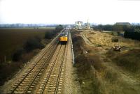
Little now remains of the Dursley Branch Line, particularly at the Dursley end of the line which has been heavy developed by industrial building within the Lister's site. Indeed in 2003 this work is continuing with new regeneration plans for the whole area. North of Lister's, Quag bridge was demolished immediately after the line closed and no sign at all remains. 
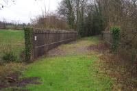
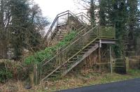
However, at Everlands in Cam, where the line ran close to the road, perhaps the most unlikely survivor is the old footbridge, known as Gallows Bridge, which stands in isolation, although usually heavily overgrown with vegetation. 
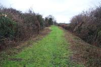
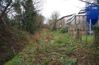
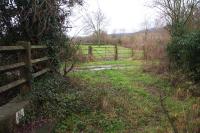
The trackbed here is reasonably distinct, although not passable due to significant undergrowth. Cam Station has also disappeared and the only sign left is the Railway Inn and the name of the street on which it stands, Station Road.
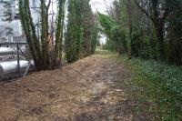
From this point, the trackbed becomes slightly more defined, especially 
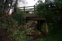
beyond the Coop supermarket at the bottom of Cam Pitch where portions 
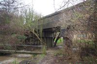
of it are accessible, although on private land. The bridge over the River Cam still stands, probably due to its solid concrete construction and north of this point the trackbed is clear up to the point where it meets Box Road, the route to the new Cam 
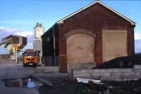
& Dursley Station. The largest surviving construction on the whole route is the old Goods Shed building at Coaley Junction, now part of a small industrial development.

 
  Picture Gallery (Click on picture for larger view)
    Site of Coaley Junction
This view of the main line at Coaley looking towards Gloucester shows the old goods shed on the right. The site for the new Cam & Dursley station, opened in 1994 is situated in the distance, a little further north than the original station and close to the bridge carrying the road to Coaley.
(1980s - copyright Bill Turner)
 
    Coaley Junction Goods Shed
Now used as part of a small industrial development the old goods shed still stands at Coaley Junction.
(1980s - copyright Bill Turner)
 
    Trackbed towards Coaley
The trackbed is still clearly defined at this point looking north towards Coaley Junction close to the bridge over the River Cam.
(January 1st 2003 - copyright Andrew Barton)
 
    River Cam Bridge
Visible here are the parapets of the bridge which carried the line over the River Cam, still in good condition 32 years after it carried its last train.
(January 1st 2003 - copyright Andrew Barton)
 
    Bridge over the River Cam
This concrete bridge, the largest such structure on the line, was built in 1948 and replaced an earlier timber one after its condition deterioriated.
(January 1st 2003 - copyright Andrew Barton)
 
    River Cam bridge identification
Below the old bridge, the identification markings can still be seen on the pillars. "Dly 106 08" indicates that it is located at Dursley and is 106 miles and 8 chains from London Road Junction, Derby via Whitacre.
(January 1st 2003 - copyright Andrew Barton)
 
    Passing the site of Draycott Mill
South of the river bridge the trackbed continues between trees and passes the site of Draycott flour mills. In this view, looking north, the bridge parapets can be seen in the distance.
(January 1st 2003 - copyright Andrew Barton)
 
    Overgrown trackbed at Draycott
Now looking south with the mill site on the right, the trackbed continues to get increasingly overgrown until it becomes impassable.
(January 1st 2003 - copyright Andrew Barton)
 
    Bridge survivor
Close to the site of Cam Middle Mill the trackbed crosses this small concrete bridge.
(January 1st 2003 - copyright Andrew Barton)
 
    Southwards over the fields
From this bridge southwards the route of the line becomes increasingly difficult to trace, either crossing open fields as here, becoming overgrown or being built over.
(January 1st 2003 - copyright Andrew Barton)
 
    Gallows Bridge
Amazingly still in existence, although no longer open to walkers, the steel Gallows footbridge is pictured here. When the line was open this bridge was often used by photographers
(January 1st 2003 - copyright Andrew Barton)