|
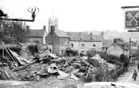
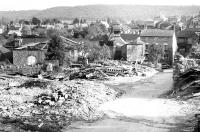
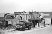
The late 1950's and early 1960's saw a lot of change to the Dursley landscape
as many old buildings in an around the town centre became surplus to requirements
and were demolished. The primary reason for this activity was the construction
of Castle Street which would ease the traffic problem in Parsonage Street
but it also provided an opportunity for opening up the area and creating
more space. In retrospect, much character was also lost and with better
foresight and planning the town could have retained more of its attractiveness.
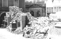
The most visible area of change was that surrounding the Market House
which saw the removal of the police station, the magistrates court, the
post-office and the effective obliteration of that end of The Knapp which
joined Parsonage Street at this point. Opposite the Market House, all
the buildings to the right of the main entrance to St.James' Church were
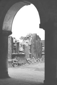
demolished resulting in the area of open lawn which exists today. Long
Street did not escape, a number of medieval buildings were removed to
make way for the new Gazette offices and several buildings were lost at
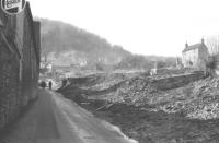
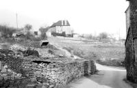
the lower end of the street to become open grassland. Elsewhere in Boulton
Lane, The Slade and Union Street, obliteration of most of the buildings
occurred to make way for an abortive relief road attempt.
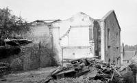
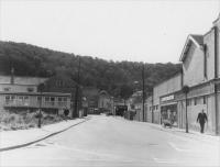
As it turned out, Castle Street was actually built in two stages, the
first from the Market House to the site of the present day Sainsbury's supermarket
at which point it curved round and rejoined Parsonage Street opposite
Broomhall's the butcher. This point had been originally been a narrow
entrance to Castle Farm but it had to be widened by demolishing the Bell
and castle Hotel which stood where Barclay's bank now stands. The second
stage of construction saw Castle Street extended so that it came out where
it does today, opposite May Lane. Once again though, further demolition
to create a gap in the terrace was needed to allow this to happen.
|